Sale on canvas prints! Use code ABCXYZ at checkout for a special discount!

Previous Image

|

Next Image
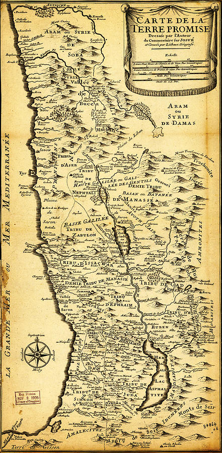
Liebauxs Map of the Holy Land 1720 Painting by MotionAge Designs
Similar Images

Imperial Federation Map of the World Showing the Extent of the British Empire in 1886 levelled by MotionAge Designs
Worlds Fair Louis by MotionAge Designs
Hondius map of the World 1595 by MotionAge Designs
1730 Stoopendaal Map of the World in two Hemispheres Geographicus WereltCaert stoopendaal 1730 by MotionAge Designs
Engraved World Map by MotionAge Designs
World Climatic Map  by MotionAge Designs
1685 Bormeester Map of the World Geographicus TerrarumOrbis bormeester 1685 by MotionAge Designs
1696 Zahn Map of the World in Two Hemispheres Geographicus World zahn 1696 by MotionAge Designs
1691 Sanson Map of the World on Hemisphere Projection Geographicus World sanson 1691 by MotionAge Designs
1728 Calmet Map of the Ancient World Showing the Creation of the Universe Geographicus AncientWorld  by MotionAge Designs
1730 Stoopendaal Map of the World in two Hemispheres  Geographicus   WereltCaert stoopendaal 1730 by MotionAge Designs
1744 Bowen Map of the World in Hemispheres Geographicus World bowen 1744 by MotionAge Designs
A Map of the World  Amy Baldwin sc by MotionAge Designs
maps pointilism World Map with leaves by MotionAge Designs
maps pointilism World Map by MotionAge Designs
maps pointilism World Map 2 by MotionAge Designs
1280 Imperial Federation Map of the World Showing the Extent of the British Empire in 1886 by MotionAge Designs
A Map of the World  Amy Baldwin sc by MotionAge Designs
Akitaya Naniwa s World Map 1785 by MotionAge Designs

Comments

There are no comments for Liebauxs Map of the Holy Land 1720.   Click here to post the first comment.

Recently Viewed

Liebauxs Map of the Holy Land 1720 by MotionAge Designs
Previous Image Next Image